Optimize complex public transporation systems

Our solution is for cities and transportation companies that would like to transform bus stops with passenger information system into population flow hubs.
Our sensors are able to count the number of people nearby bus stops, the number of people in a range of 100 meters, the average waiting time at the bus stop, returning rates and more.
By building a network of sensors it is also possible to create a city-wide population flow map which can be used to to offer better urban planning, adapt public transportation and understand who are the tourists visiting the cultural sites and shopping areas.


Crowded places such as MRT stations and transportation hubs are risky places during public health crises such as the COVID-19 crisis.
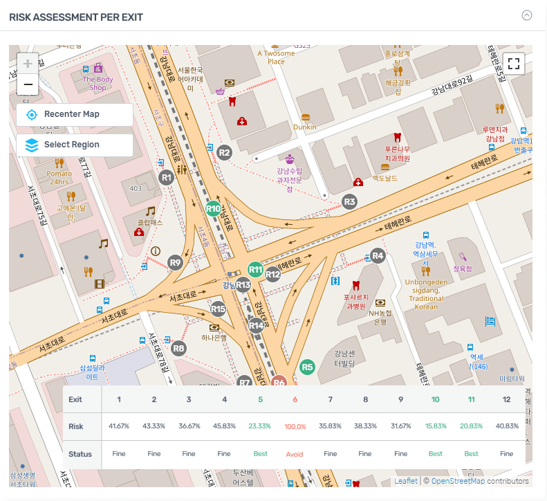
A straight-forward strategy to minimize the risk of infection is for subway users to avoid crowded areas and select less crowded exists.
Our crowd analytics risk assessment system provides real time recommendation for passengers and which exit they should use in order to minimize the risk of COVID-19 infection.
This recommendation is based on risk analysis of each individual in the crowd in addition its density and therefore can be significantly more accurate compared to simple crowd density analysis
The LiveWalk 2022 GPS sensor let’s you track the location of a sensor deployed in vehicules such as cars and buses to view crowd data for each location logged along the sensor’s path.
Copyright © 2022 DFRC
43 Science Park Road #01-11 Rm 8, Singapore 117408
